
Polish Team Digitally Records Kościuszko's West Point Fortifications
A three-person team from Poland used 3D scanning and gigapixel imagery to preserve Revolutionary War sites and artifacts at the U.S. Military Academy
By AXY Defense Desk ·
Key points
- A three-person team from Poland worked at West Point from Sept. 14 to 29 to digitally record Revolutionary War sites and artifacts linked to Tadeusz Kościuszko.
- The project used terrestrial laser scanning, structured-light scanning, aerial photography and gigapixel imagery.
- The records are intended as a baseline for future conservation of earthworks that face continual erosion.
- Kościuszko fortified West Point and other sites during the Revolution, and the source says the British never attempted an assault on West Point.
- The digital records may eventually support virtual walkthroughs of West Point's historic sites.
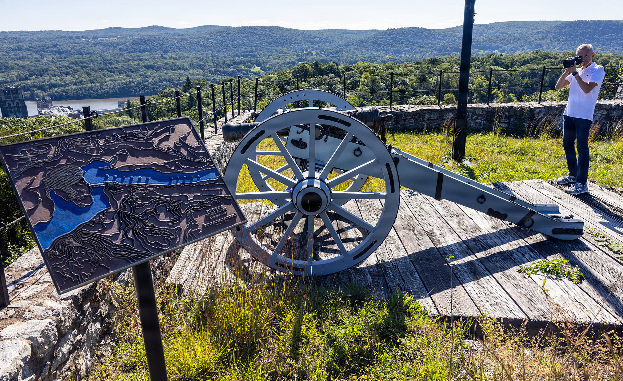
A team from Poland and West Point have digitally recorded Revolutionary War-era sites and artifacts linked to Tadeusz Kościuszko, the Polish-born engineer who helped fortify the U.S. Military Academy during the American Revolution. According to West Point, three members of Poland's Foundation for the Virtualization of National Cultural Heritage spent Sept. 14 to 29 at the academy using 3D scanning, aerial photography and other digital tools to create what the academy described as precise, lasting records of Kościuszko's material heritage. The project, titled “Tadeusz Kościuszko at West Point: The Digital Heritage of the Polish-American Hero of Freedom,” was first reported by Defense News.
Who did the work and what they recorded
The Polish team included Piotr Bialobrzycki, Damian Kuc and Jerzy Pajor. Bialobrzycki is the project director and led terrestrial laser scanning of eight heritage sites at West Point. Terrestrial laser scanning is a method in which a stationary scanner fires laser pulses at surfaces in every direction and measures the distances back, producing a dense three-dimensional point cloud of a location. Kuc, described by West Point as the project's lead specialist in 3D scanning and modeling, used structured-light scanning to document cannons, commemorative plaques, elements of the Kościuszko Monument, the Great Chain and selected artifacts, including Kościuszko's sword at the West Point Museum. Structured-light scanning projects a known pattern of light onto an object and uses the distortion of that pattern to calculate its shape, which is well suited to small objects and fine surface detail.
Pajor, who has a background in professional photography, documented the sites with multimedia and gigapixel imagery. A gigapixel image is a very high-resolution picture made by stitching together many photographs, and it can contain billions of pixels of detail. According to West Point, this material will eventually support virtual walkthroughs of the historic site.
Why the project matters now
The project was framed as a preservation effort. West Point's earthwork fortifications and landscapes face continual erosion, meaning that rain, wind, frost, foot traffic and time gradually wear away the physical shape of the ground and structures. Earthworks, which are defensive walls and mounds built largely from soil, are especially vulnerable because they depend on their shape rather than on hard materials. Once they are eroded or altered, the original contours can be difficult or impossible to recover with certainty.
In a news release quoted by West Point, the project was described as providing “a benchmark for future conservation” and as eventually allowing people around the world to explore historic resources at West Point virtually. Read in that light, the digital records are a snapshot of the sites as they exist today. Conservation specialists could later compare new measurements against this baseline to see how terrain, stone, metal and monuments have changed. That kind of comparison is one of the main reasons preservation projects increasingly rely on digital documentation.
Kościuszko's role in the American Revolution
Kościuszko's connection to West Point is central to the story. He arrived in the American colonies after a turbulent period in Poland, and his path into the war was unusual. According to the Smithsonian, which Defense News cited, Kościuszko was hired as a tutor for Louise Sosnowska, the daughter of a wealthy lord. The pair fell in love and attempted to elope in the fall of 1775 after Lord Sosnowski refused Kościuszko's request. The Smithsonian quotes Kościuszko's account of the attempt, in which Sosnowski's guards overtook their carriage, forced it to stop, knocked him unconscious and took Louise home. Afterward, Kościuszko left Poland and sailed across the Atlantic in June 1776.
Once in Philadelphia, John Hancock appointed him a colonel in the Continental Army that October. Benjamin Franklin then hired him to design and build forts on the Delaware River to help defend Philadelphia against the British navy. Military engineering of this kind was a crucial skill for the young Continental Army, which lacked trained engineers in large numbers and relied heavily on skilled foreign officers.
Kościuszko's later work is also documented in the source material. He oversaw the damming of rivers and the flooding of fields to slow a British pursuit after the British victory at Fort Ticonderoga in 1777. That delay gave American forces time to regroup before their victory at Saratoga, which the source describes as their first major win of the war. At Bemis Heights, overlooking the Hudson River, his fortifications contributed to the surrender of General John Burgoyne and helped bring France into the war on the American side.
Fortifying West Point
West Point sits on high ground above a sharp bend of the Hudson River, a position that made it strategically valuable. Control of the river allowed armies to move troops and supplies between the northern and southern colonies, and the British sought to split the colonies along that route. Kościuszko oversaw the defense of West Point, and according to the source, his fortifications were so thorough that the British never attempted an assault on the position. Analysts of the period often point to such deterrence as one of the most important, if least visible, achievements of military engineering: a successful defense can prevent a battle entirely.
The physical remains of this work are what the new digital project seeks to capture. Earthworks, redoubts and other defensive features built in the 1770s are now part of a national historic landscape that visitors, students and researchers study. Documenting them in three dimensions gives historians a way to examine how the terrain was used, how lines of sight were managed and how defenses were arranged, without relying solely on old maps and written descriptions.
Recognition and legacy
At the end of the war, Kościuszko was promoted to brigadier general. Thomas Jefferson later praised him in the source material as “as pure a son of liberty as I have ever known.” Kościuszko returned to Europe after the war and later led a national uprising in Poland in 1794, a fact widely recorded in histories of both countries. His reputation in the United States and Poland has since been tied to a shared story of independence, and monuments, museums and place names in both countries keep that memory alive.
Bialobrzycki framed the project in those terms. “We wanted to use this moment to demonstrate that the Polish contribution to the American Revolution was concrete and consequential,” he said. “Its traces can still be read in the terrain, fortifications, monuments, documents and historical objects at West Point.” His remark reflects a broader argument that the contributions of foreign volunteers and officers were not symbolic but practical, and that physical evidence can still be used to test that claim.
What comes next
The scanning and imaging work completed in September is the first stage. The digital records still have to be processed, checked for accuracy and organized so that conservators, historians and the public can use them. Scans of this size typically require careful data management, because point clouds and gigapixel images can contain very large volumes of information. The sources do not say when the virtual walkthroughs will be released or how the records will be made available, so those details remain open.
Analysts following heritage preservation expect that digital records of this kind could become a reference point for future decisions about maintenance and repair. If erosion continues, comparing successive scans could show where earthworks are losing height or where drainage is changing the ground. Such evidence could help managers decide where to spend limited conservation budgets. Whether that happens will depend on how the academy and its partners decide to maintain and share the data over time.
For readers, the project is a reminder that history is partly a physical record. The sword, the cannons, the plaques and the ground itself all carry information about the decisions made during the Revolution. By turning those objects and sites into durable digital records, the team hopes to keep that evidence intact even as the originals weather, and to let people anywhere examine the place where, in the words of the project, Kościuszko's material heritage still stands.
Topics: Tadeusz Kościuszko, West Point, Polish-American history, 3D scanning, digital heritage preservation, Continental Army, Revolutionary War, Foundation for the Virtualization of National Cultural Heritage
Sources: Defense News